
The Japan Aerospace Exploration Agency (JAXA), NEC Corporation and NEC Space Technologies, Ltd. have achieved GPS navigation, in which GPS signals are used to determine the time, position and velocity of satellites to a high degree of accuracy, at a geostationary orbit for the first time in Japan. The companies realized GPS navigation using a geostationary satellite GPS receiver mounted on an optical data relay satellite launched on November 29, 2020.
GPS navigation is being widely employed in low-orbit satellites for purposes such as determining orbits with a high degree of accuracy, ensuring accurate time references for satellite-mounted systems, and increasing management efficiency through the autonomous orbit control of satellite-mounted systems, and as such it is proving useful for enhancing the capabilities of satellites.
GPS navigation is a technology that utilizes GPS signals transmitted from GPS satellites. It determines the time, position and velocity of a GPS receiver with a high degree of accuracy by measuring the distance between the GPS receiver and a number of GPS satellites, and the time lag of the GPS receiver.
In principle, it is necessary to receive signals from four or more GPS satellites. Additionally, although GPS is a system premised on being used on the ground, GPS navigation is possible even in outer space, far removed from Earth, provided GPS signals can be received.
However, GPS satellites send GPS signals to the Earth's surface, targeting users at altitudes of 3,000 kilometers or lower. Consequently, although signals from GPS satellites on the other side of the Earth reach geostationary satellites, which are positioned at higher altitudes than GPS satellites (approximately 36,000 kilometers), given their considerable distance from the GPS satellites those GPS signals are faint and difficult to perceive, and as such, up until now GPS navigation had not been widely adopted for use with geostationary satellites.
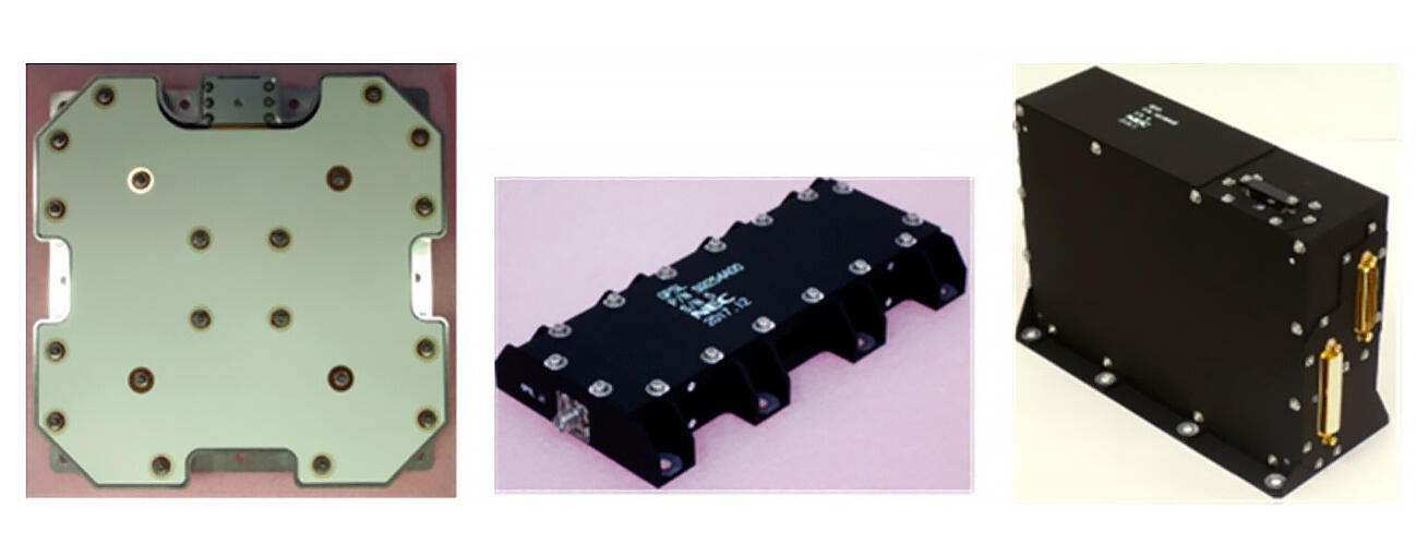
Now, technology jointly developed by JAXA and NEC that makes it possible to capture, track and decode the messages of weak GPS signals has been employed in a geostationary satellite GPS receiver mounted on an optical data relay satellite. The companies confirmed that by using this receiver, geostationary satellites can receive GPS signals from four or more satellites in orbit, allowing them to continue running the GPS navigation process in a stable manner.
This will make it possible to significantly improve the capabilities of geostationary satellites, including by enhancing their operating efficiency through autonomous navigation and orbit control, boosting the geometric correction accuracy of satellite imagery, and making the time references of satellite-mounted systems more precise.
On the basis of these research and development results, NEC Space Technologies, a maker of satellite-mounted equipment that has a track record of fitting satellite communication devices to a large number of satellites at home and abroad, is in charge of developing, manufacturing and marketing these receivers, and began selling them inside and outside Japan from spring this year.
Furthermore, JAXA and NEC are continuing to make further improvements to the receivers. They plan to implement an autonomous orbit control using an improved geostationary satellite GPS receiver on Engineering Test Satellite-9, which is currently under development at JAXA and is scheduled to be launched in FY2023.
This article has been translated by JST with permission from The Science News Ltd.(https://sci-news.co.jp/). Unauthorized reproduction of the article and photographs is prohibited.